Are you finding it hard to get your news story published in the mainstream media?
Look no further - share it FREE on NewsBoosters and reach the people directly
Footprints Childcare, India's renowned preschool and daycare brand, today announced the launch of its revolutionary AI assistant, boasting an impressive 98% accuracy rate. This innovative techn... Read more...
Hypnotherapist Leslie Reynolds, CH highly successful therapy program is revolutionizing the way addiction is being treated with his proprietary cutting-edge solution
Do you often experience abdominal pain or discomfort? Have you noticed differences in your bowel habits, such as diarrhea or constipation? These could be signs of Irritable Bowel Syndrome (IBS), a ... Read more...
Noida: Marwah Studios Film City in Noida witnessed a spectacular culmination as the Asian Sports Star League Grand Award Function marked the grand finale of the three-day extravaganza. Organized by... Read more...
Thyroid problems are becoming a serious concern in our fast-paced world. Dr Mangesh P Desai - an educated Best Ayurvedic Doctor in Pune, can offer precious perceptivity on how Ayurvedic drugs ... Read more...
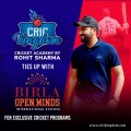
Birla Open Minds Education Pvt Ltd, a leading educational institution that provides a comprehensive solution for children's learning needs from early childhood to K-12 schooling collaborates wi... Read more...
Jaipuria Institute of Management is pleased to announce that applications are now open for its highly esteemed AICTE Approved Doctoral Level Fellow Programme in Management (FPM). Designed to foster... Read more...
QuestPix, a leading online learning platform for IIT JEE preparation, proudly announces the launch of its cutting-edge mobile application designed to revolutionize the way students prepare for the ... Read more...
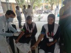
Times Employ India Foundation - a CSR Solutions Wing of TimesPro, in collaboration with Bharat Petroleum and the Department of Tribal Affairs, Jhabua successfully completed a health and hygiene pro... Read more...
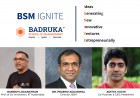
Badruka School of Management (BSM), an institute of Badruka Educational Society, has introduced BSM IGNITE (Ideas Generating New Innovative Ventures Entrepreneurially), a business case competition.... Read more...